
How to search Logan property records
A Logan mailing address can point to the city, to West Logan, or to unincorporated county land nearby. The town keeps its own layer. It never replaces the County Clerk or the Assessor.
- Use Logan's street or E-911 address as a starting clue in the Logan County assessor search.
- Save the account, district/map/parcel, situs, mailing, class, value, and deed reference.
- Check the clerk's Cott link for a recent deed, trust deed, lien, or release.
- Use the statewide viewer to compare community, E-911, parcel shape, and current place boundary.
- Ask Logan City about permits or land-use forms for municipal work at the address.
This quick route keeps the city question separate. The county-wide search mechanics are handled elsewhere. Detailed address and owner steps appear on the Logan County property search page. Logan property records still depend on matching one parcel across the town and county layers, so anchor every lookup in that shared parcel number.
Logan city and county record offices
Ownership and tax records for Logan rest with the county. The County Clerk records deeds and plats. The Assessor maintains the land accounts and values. The Sheriff handles tax collection and redemption. Logan City adds permits and other municipal actions. Its resource center is a form library. It is not a searchable case database, so treat it accordingly. A city permit is not a deed. An assessor improvement is not proof that a permit was issued.
Logan County custodians
Clerk and Assessor
300 Stratton Street
Logan, WV 25601
Clerk 304-792-8600
Assessor 304-792-8520
Logan property records run through county offices. Permits are the city's piece. Call the municipal desk for a permit file or form, and call the assessor or clerk for an owner, tax account, or recorded deed.
Logan subdivisions in the recorded books
No named subdivision index exists in the clerk's books. Neighborhood plats surface one by one, not as a list. The County Clerk's fee page lists a plat map at $11. Confirm the current local amount before requesting a copy. A recorded plat is the authoritative source for an exact addition, lot range, book and page. It also pins the era. Skip names that listings invented.
| Neighborhood or subdivision | Era | What the record search can confirm |
|---|---|---|
| Named Logan subdivision not verified | Not established in inspected official sources | Request plat index by lot, deed reference, or map/parcel |
| Logan city lot or addition | Depends on the recorded plat | Check lot, road, and right-of-way geometry |
| Historic tract or survey | May predate a street number | Compare acreage, creek/river, survey, and adjoining names |
A legal description may omit the modern street address. Keep the deed's book and page handy. Keep the map and parcel number beside it. GIS shows today's tax shape, while the clerk's recorded drawing supplies the lot context. Attach a subdivision name only if it appears in an official plat or city record.
Dingess Street forms and Logan permits
Logan City's resource center lists a B&O Form, a Building & Fire Code residential permit, a Building Permit Application, a Sign Permit Application, and a Business License Registration. Those titles are the city-specific access route. The center offers no searchable permit-case database. There are no date filters or result caps. For a permit request, supply the street address, parcel or account if known, work type, and approximate year.
Ask in return for the permit number, issue date, applicant, scope, inspection or final status, and copy fee. Those are useful request details. The PDF forms make no promises about exact fields or municipal charges, so confirm both with the office.
Logan City's official resource center posts the building, fire, sign, and business registration forms. The official page displays the form list.
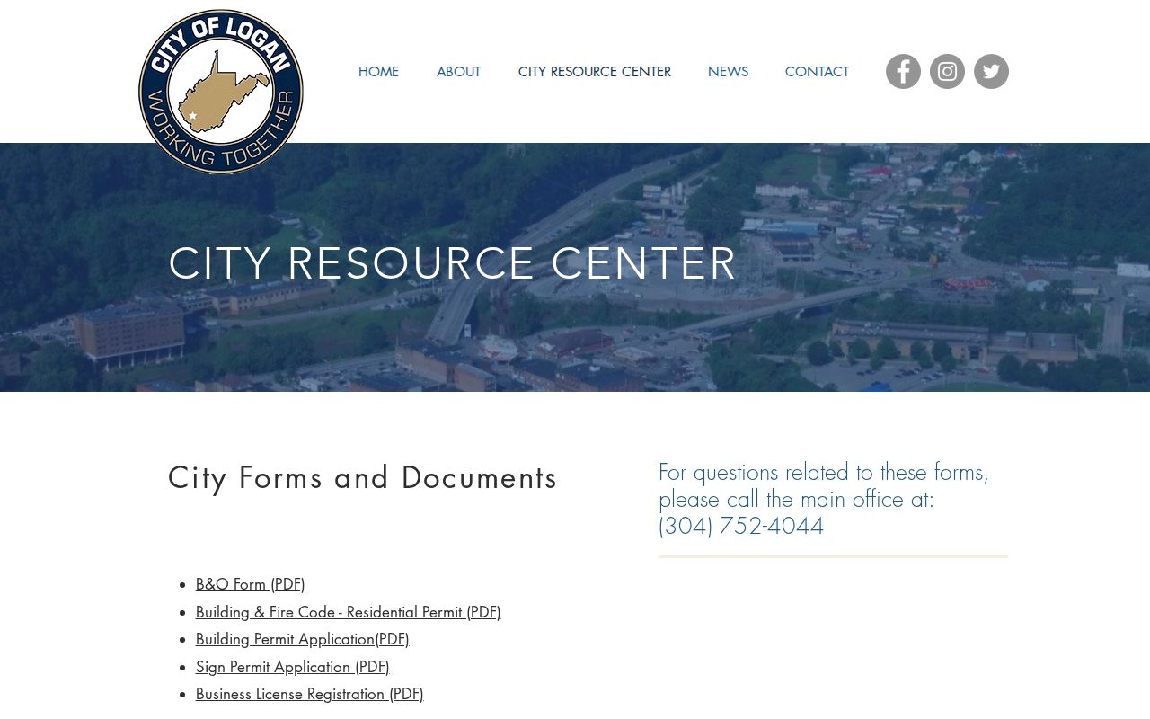
The city form library can explain municipal work history. County property records remain the source for ownership and assessment, so pair the two when a project's history matters.
Logan city is not every Logan address
A "Logan" postal label can point to the city, West Logan, or a nearby county community. Mail city and ZIP are weak clues. The county holds many unincorporated places. River valleys and hollows stretch well past any town line, so the Census or GIS polygon is the better test. Exact ZIP coverage, crossing ZIPs, street renumbering, and annexation ordinances answer only from city documents.
When the city line matters, select the parcel in WV Property Viewer and compare it with current place geometry. History needs different papers, so request Logan City council minutes, annexation ordinances, maps, or street-address history. A current polygon can't reconstruct an old annexation.
Keep the city label and county legal description separate. That split keeps Logan city distinct from broader Logan County and from West Logan. Blend them and lookups drift.
Use Logan assessor labels for the city parcel
For a Logan city address, the assessor account is the county reference. It ties the owner field and tax values to a parcel. Logan's physical, E-911, community, and mailing labels can diverge. Keep each label beside the legal description. The county-wide steps sit on the property search page.
Before treating a card as a Logan city parcel, compare its mapped spot. Check it against the current incorporated-place polygon. The owner field names the tax account. A deed book and page points to the recorded transfer. A mail city alone cannot resolve a Logan versus West Logan boundary question.
Keep the city label and county parcel number together. Do this when lining up tax data with city permit files. That pairing preserves the Logan lens. It avoids repeating county-wide steps, and it keeps the tax roll and permit file speaking about the same parcel.
Logan E-911 and value context
WV Property Viewer pulls a Logan city account into its valley setting. It shows the E-911 address, the Community label, and the physical address. It also lists the property owner, building information, cost values, appraised values, flood details, and neighboring parcels. Those fields are what place a parcel in the Guyandotte valley. Treat them as three different things. The E-911 address aids location. The Community is a local label. A mailing town is neither. When all three differ, keep all three.
Scale matters too. Logan city counted 1,439 residents in the 2020 Census. That is a historical Census count, not a current estimate. Logan County spreads across more than 450 square miles. It includes many unincorporated communities, so a result labeled Logan deserves a boundary check before anyone calls it a city parcel. The Census incorporated-place table publishes that population figure and the roster it comes from.
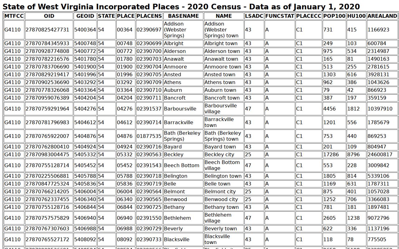
Use the Census count for historical scale only. It is neither a present-day population estimate nor a boundary definition. The assessor offers no value-trend series for the city itself. For local context, the assessor's separate Sales Search filters by date, price, square footage, acreage, property type, qualification, and sale type. Compare only like properties. Note the town boundary before trusting any match. A recorded consideration is one transaction, not the assessed value and not a guaranteed market estimate.
Property class changes with location. Class II covers owner-occupied residential property and owner-used farms. Inside a municipality, comparable taxable property may fall under Class IV. Outside one, it may be Class III. The Logan parcel's class and assessed value stay with its account, while a sale comparison stays with the transaction details. The Logan County parcel-map route helps check a selected location against the city edge.
Follow older Logan land descriptions
Logan's oldest property history rarely speaks in modern city streets. A description may name a tract. It may name a river or creek, a survey, an adjoining owner, or a lot. The WVU finding aid gives the route. Grantor reels run LOG 1-4. Grantee reels run LOG 5-8. Deed books run LOG 9-19. Surveyor records run LOG 177-179 and 202, and land books run LOG 181-188. That path answers older ownership and subdivision questions. It helps when a current assessor card only points to a recent transfer.
Start with the present. Write down the current deed reference and legal description. Then work backward through both index roles, grantor and grantee. Ask the clerk or WVU for the exact reel, deed book, or plat. Logan property records from before the Cott 1988 online convenience range still exist. They simply require a different access channel. A plat can tie a city lot to its recorded geometry. Remember that GIS remains a tax map, not a survey.
Costs are modest. The clerk's fee chart lists plat maps at $11. For a true boundary decision, obtain the recorded document and consult a licensed surveyor.
Limits of Logan city property records
Some things Logan property records simply do not contain. The official city pages publish no verified list of neighborhood names, no city permit-case search, no ZIP boundary list, and no annexation timeline. Ask the city for permit and boundary records. Ask the clerk for plats. Real-estate listing language should never fill those gaps.
Lawful use. Use city and county records for property research and civic diligence. A record is not a title search or survey, and owner details must not be used to stalk, threaten, harass, or expose anyone.
Each office answers a different question. Logan City's permit forms, the county assessor, the County Clerk, and WV Property Viewer each cover separate ground. Compare their dates and parcel references before drawing any conclusion about an owner, a boundary, or an improvement.