
Sources for a Logan County property block
A Logan County neighbor lookup is really a parcel exercise. Start from one known property. Read the parcels that touch or sit near it. Then run each identifier through the assessor to pull the tax account. The county viewer offers no named buffer or adjacent-parcel command. So the work is manual selection and careful identifier checking. A GIS map shows nearby land. An owner card still proves nothing about who occupies it.
| Source | What it shows around a property | Access path |
|---|---|---|
| WV Property Viewer | Selected parcel and surrounding shapes | Search, select, and read parcel details |
| Logan assessor | Owner, account, address, and value fields | Use Parcel Address or Map/Parcel |
| Recorded plat | Lots, roads, additions, and rights of way | Request from the County Clerk |
| Recorded deed | Legal description and named adjoining context | Use book/page or Cott index |
Each source does one job. The GIS map identifies the block. The assessor matches parcels to tax accounts. The clerk holds deeds and plats. Keep the parcel number and legal description with every neighbor result.
Select a Logan County subject parcel first
Begin with the address or account of the parcel at the center of your question. Logan County's assessor property search offers several keys. It accepts Parcel Address, Owner Name, Account #, District, Map/Parcel, Property Type, Legal Description, and Deed Book/Page. Owner names go in LAST FIRST order with no comma. Copy the full map/parcel and account number before opening the map viewer.
Normalize the street name, suffix, house number, and community label. Logan's valley and hollow geography complicates addressing. A mailing city, a physical address, and an E-911 label can all differ. If the address is unclear, lean on a prior tax bill. A deed reference, the legal description, or the map/parcel itself also works. The goal is a second key confirming the subject parcel before you read neighboring shapes.
Never start from a person's name and assume the nearest parcel is theirs. Verify the owner card and the location after selecting the subject.
Read Logan County parcels around the selection
Open WV Property Viewer and select the known parcel. The visible map reveals nearby parcel outlines. Read each shape's displayed number or assessment-report link. The card can show the property owner, physical address, E-911 address, community, building information, appraised and cost values, delinquency status, flood data, and external map links. That card is dynamic, so keep the account identifier and check it against the assessor. The statewide parcel viewer is the public map route. Its selection view displays the subject parcel and the surrounding map context.
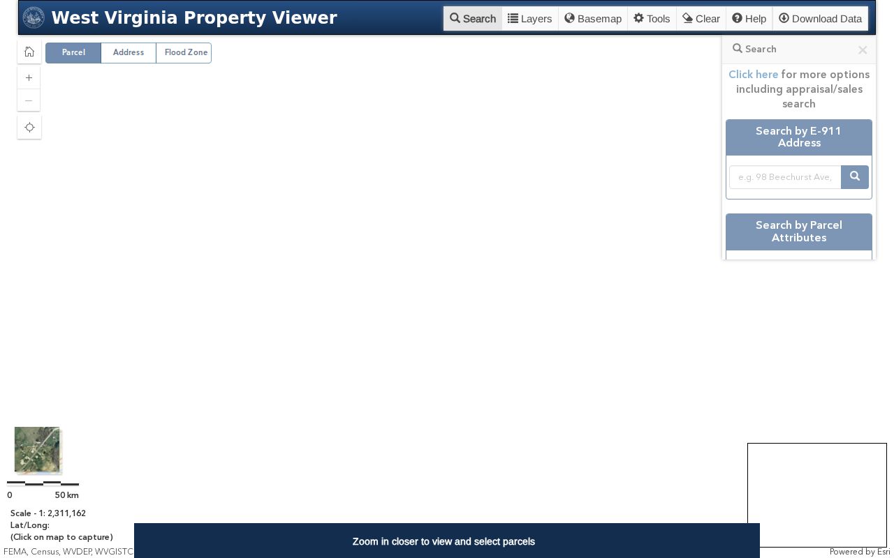
Read the map as a set of neighboring tax parcels, then use those identifiers to retrieve the separate owner records.
Logan County has no verified buffer tool
Logan County publishes no named buffer tool and no "select by location" command. The statewide viewer also offers no automatic adjacent-parcel report. Do not expect one. The manual method works fine. Zoom around the subject parcel and record the numbers visible at the edges. Select each neighboring shape in turn. A number may be too small, or a boundary may be hard to see. In that case, pull a recorded plat or call the assessor for the map identifier.
Copy Link preserves a selected view. Download KMZ supports separate map review. Neither control creates an official list of neighbors. Neither one confirms a shared line as a legal boundary. A road right of way, a stream, or a small lot may lie between the shapes. Parcels that look connected at low zoom can be fully separate.
Keep the date and viewer source with your neighbor notes. That habit separates a map observation from an owner lookup or a survey conclusion.
Match each Logan neighbor parcel to an owner card
Once you have an adjacent parcel number, search the assessor by District and Map/Parcel. You can also search by Account #. Copy the form's four map/parcel inputs exactly. The county has not documented its precise numbering scheme in the public instructions. If a map value returns nothing, try the legal description. Try the deed book and page, or the owner name format from another record.
For each account, save the owner of record and mailing address. Save the situs or physical address, class, values, and deed reference too. A mailing address can sit outside the block or outside Logan County entirely. The property owner may not occupy the parcel. A tax account is never a list of household members. Describe each result as an adjacent parcel's assessor owner, not as who lives next door.
For a consequential ownership question, confirm through the clerk's recorded deed. A neighbor's tax card and a GIS map answer different parts of the block question.
Use Logan County E-911 and community labels carefully
The viewer's E-911 and Community fields tie a selected parcel to a local place name. Treat them as clues. A mailing town, a physical address, and a city limit can all disagree. A Logan address may sit inside Logan, West Logan, or an unincorporated community. Chapmanville and Man addresses deserve the same boundary check. ZIP codes follow postal routes, not legal limits.
For a modern boundary question, check the current incorporated-place polygons. Older questions need more. City ordinances, council minutes, maps, and address records document a historic line. They can also document a street change. On a block that crosses a municipal line, the parcel's location and class matter more than its postal place.
Keep the assessor card's physical, mailing, and E-911 values side by side. Each describes a different route to the same land.
Logan plats show lots and rights of way
When neighbor shapes on the map get confusing, a recorded subdivision plat clears things up. Plats show lots, roads, reserved rights of way, and additions. The clerk's local fee chart lists plat maps at eleven dollars. Specific subdivision names and book/page references for Logan and nearby towns are not published here. Never carry a real-estate listing's neighborhood name into the record without a plat behind it.
Ask the clerk for a plat. Use a deed book/page, lot, addition, tract, or known parcel reference. Then compare the drawing with WV Property Viewer, and note where roads or lot lines differ. The plat gives recorded geometry. Current ownership still comes from later instruments and the assessor's account.
A shared fence, an encroachment, or a purchase boundary calls for a licensed surveyor. Plats and GIS maps frame the question. They do not mark the line on the ground.
Mailing addresses may leave the Logan block
The assessor mailing address shows where the tax bill goes. It does not prove who lives on the mapped lot. An LLC, a trust, an estate, or an out-of-county owner may hold the property. A neighbor lookup can identify the tax account and the owner of record. But occupancy, routines, and personal contact details are not what these records carry.
West Virginia's Address Confidentiality Program gives qualifying survivors a substitute mailing address. It includes mail forwarding for government transactions. It does not erase every public deed or assessor entry. Avoid publishing a vulnerable person's location. For a specific redaction or protected-record rule, ask the custodian who holds the record.
The West Virginia Address Confidentiality Program describes the substitute-address route. A public record still answers to lawful-use and safety limits.
A map serves civic research and property diligence. It should never become a personal-location profile.
When Logan County boundaries need a survey
Abutting on a screen is not abutting on a deed. A road, stream, right of way, or unrecorded change can shift the apparent edge. Tax maps exist for parcel identification and assessment support. A deed supplies the legal description. A plat supplies recorded layout. A surveyor then locates the line on the ground.
Use neighbor records for lawful property research. Do not use owner names, map links, or addresses to stalk, harass, threaten, trespass, or target anyone. A parcel lookup is not a roster of residents.
A boundary dispute or a planned purchase deserves a paper trail. Collect the subject and adjacent map/parcel numbers, deed book/page references, legal descriptions, and any plat. The clerk can issue certified instruments. A licensed surveyor provides the measured location. That gives Logan County neighbors a verifiable record trail instead of map-pixel guesswork.